![]()
Hiking
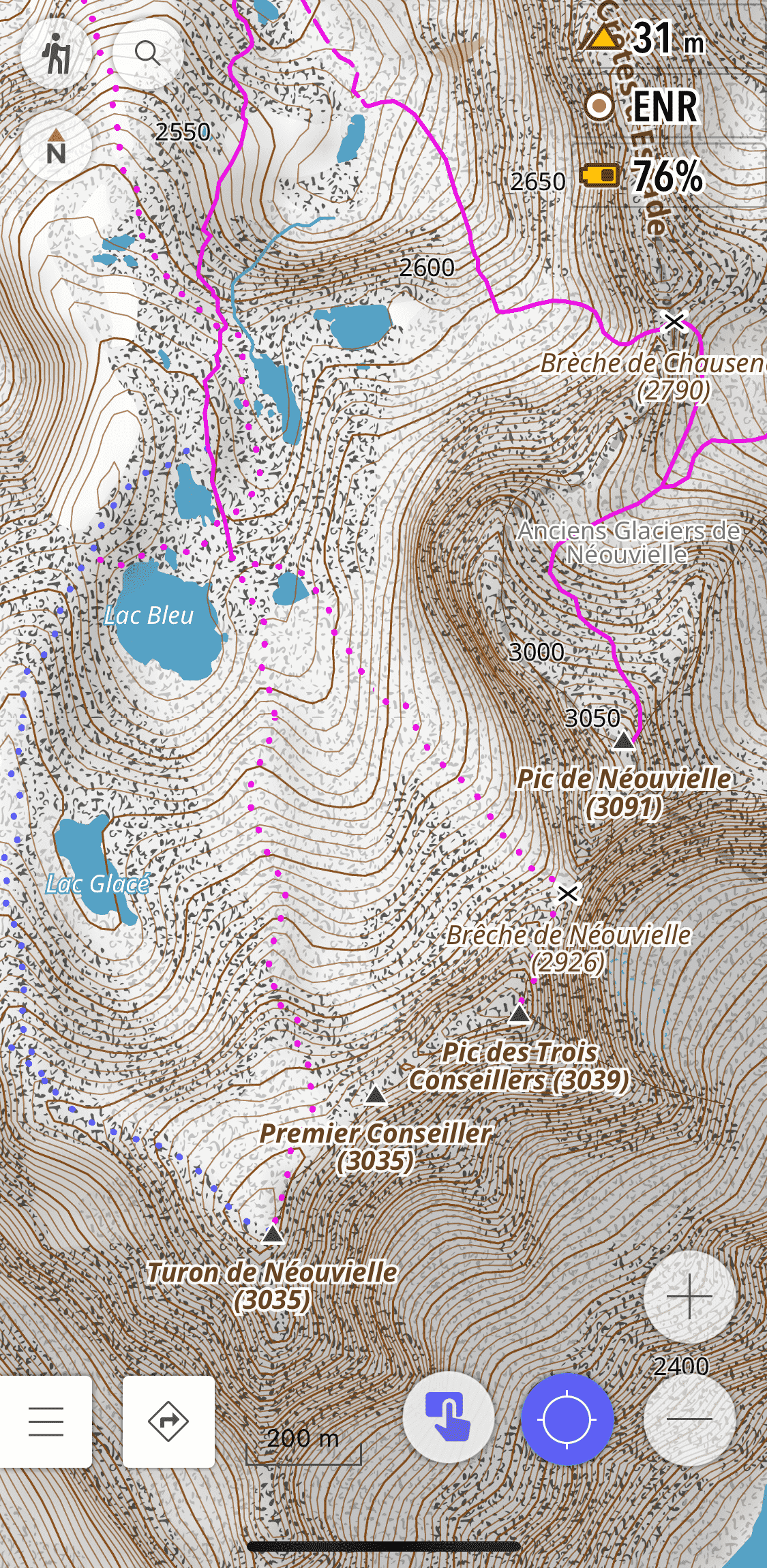
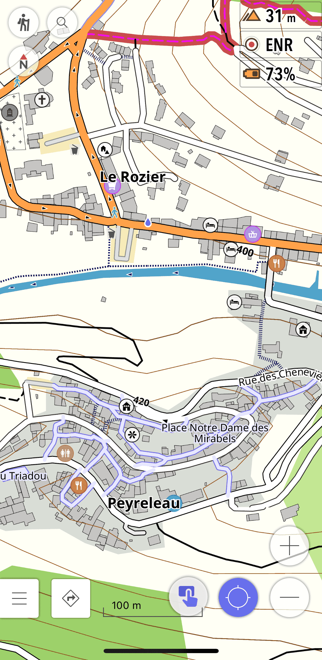
For the hike we realized that it was necessary to juggle several styles of map to have certain information. This style is based on OsmAnd's Topo style, among other things it improves the readability of the map and a more realistic representation of the terrain.
Notable features
- Thicker paths and tracks
- Difficulty and visibility of the trails
- Useful / interesting POIs highlighted
- Color of land and water occupations
- Natural reserves
- Opaque color for routes based on OSMC symbols
- Additional settings
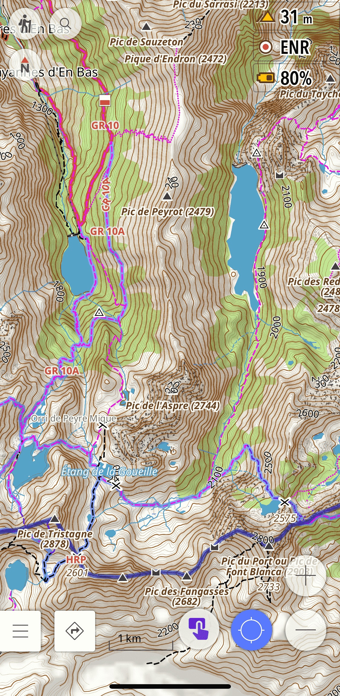
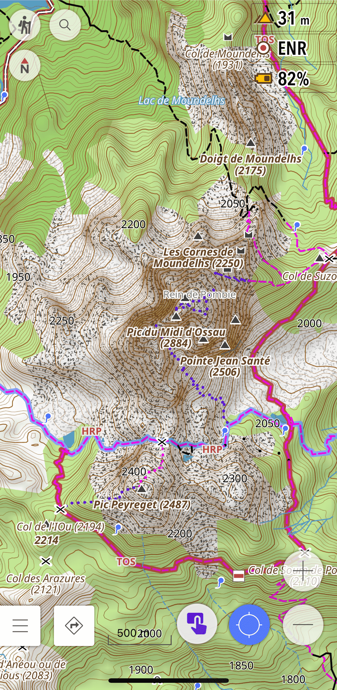
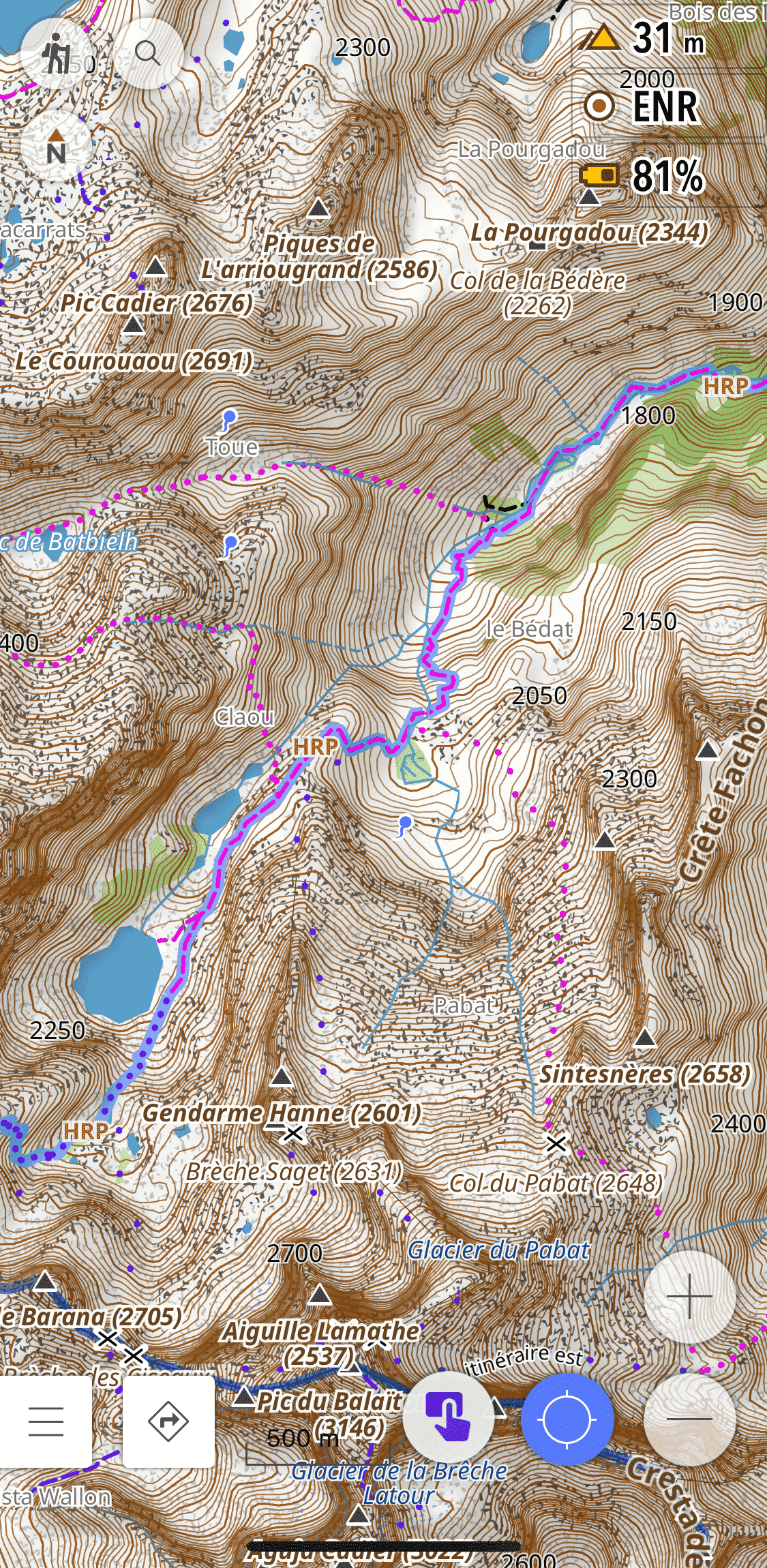
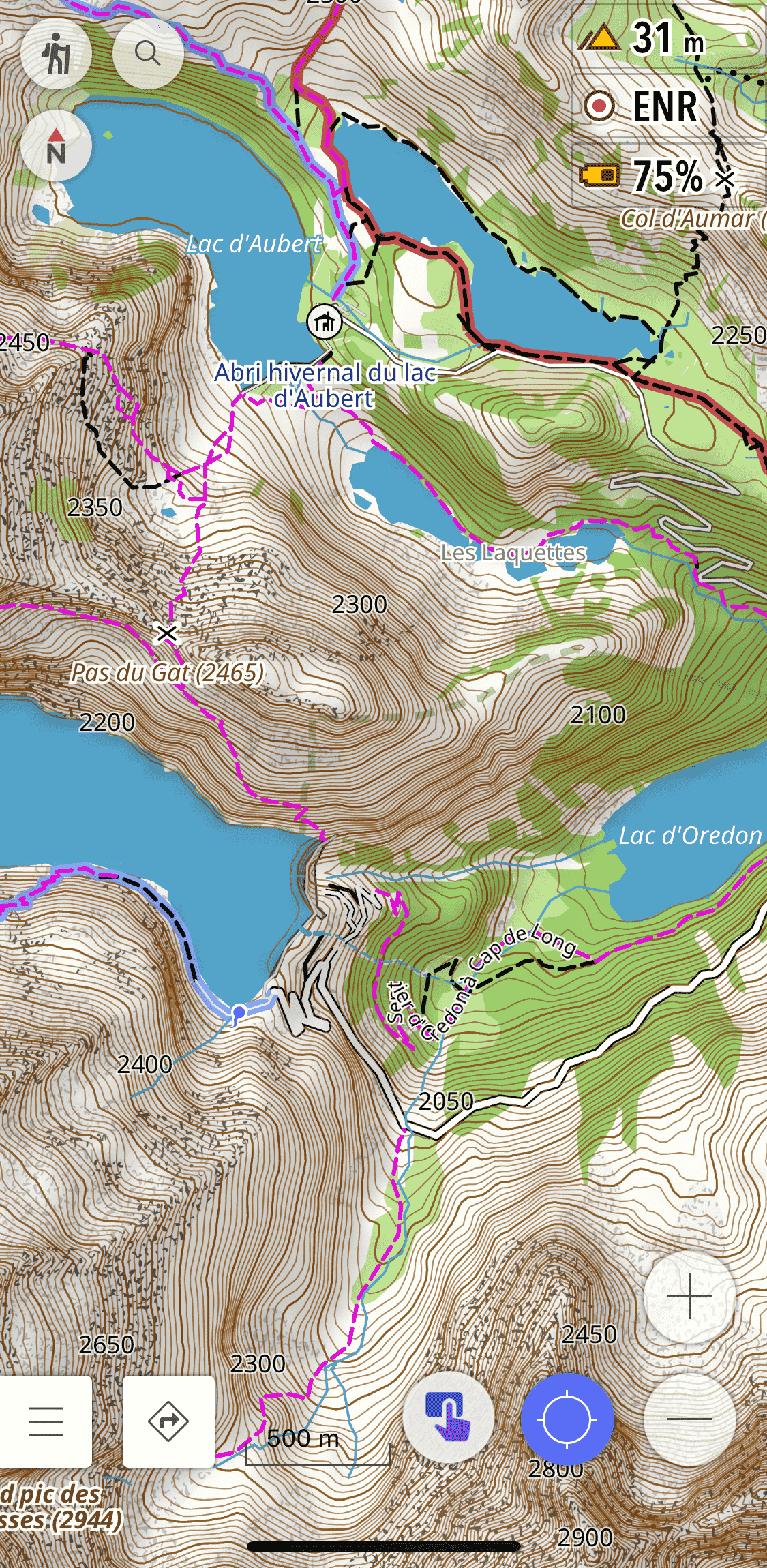
Screenshots
Installation instructions
- Download this file
First installation |
|---|
|
Update of the rendering |
|---|
|
Documentation
Améliorations du style
What has changed:
- Trails and paths / track in a simplified way
- Difficulty of trails
- Visibility of the trails
- Bridges
- Useful / interesting POIs during the hike are surrounded by a white circle to highlight them
- POIs useful when passing through a hamlets / village / town, are pre-activated and surrounded by a colored circle depending on the category
- Contour lines
- Color of land and water occupations
- Symbols of land use (Shader)
- Cols and mountain pass
- Information panels
- Towns / villages / hamlets
- Text size
- Natural reserves
- Ridge lines, gorges, corridors, valleys, mountain names
- Antennas, towers (buildings), wind turbines icons
- Opaque color for routes based on OSMC symbols
We have added additional settings:
-
"Hide" settings:
- Symbols of nature reserves
- Color of nature reserves
- Visibility of the trails
- POI pre-activated
- Land use symbols
-
Contour line settings
- Additional density
- Extra thickness
We have disabled:
-
the quality of the surfaces (Smoothness)
Legend
Trail (
|
|
| Normal - Wider black lines - Elongated shape - Softened |
|
| Access « No or private » - Red-brown lines - Elongated shape - Softened |
|
Track/Agricultural track/forestry track (
|
|
Grades 1 and 2 (tracktype=grade1/grade2)
|
|
| Normal - Black line - Discontinuous line on the sides |
|
| Access « No or private » - Red/brown lines - Discontinuous line on the sides |
|
Grades 3, 4 and 5 (tracktype=grade3/grade4/grade5)
|
|
| Normal - Black line |
|
| Access « No or private » - Red/brown lines |
|
Difficulty and visibility of trails (
|
|||||||
| Trail visibility |
CAS scale |
T1 | T2 | T3 | T4 | T5 | T6 |
| No | |||||||
| Horrible | |||||||
| Bad | |||||||
| Intermediate/Good/Excellent Visibility disabled |
|||||||
| Visibility CAS disabled |
|||||||